 Live Music Archive
 Librivox Free Audio
 Metropolitan Museum
 Cleveland Museum of Art
 Internet Arcade
 Console Living Room
 Books to Borrow
 Open Library
 TV News
 Understanding 9/11
tv CNN Newsroom CNN March 2, 2012 12:00pm-1:00pm PST
12:00 pm
records this rain, the hailstorm, the wind they actually had to drive through that in the area at the time was under a threat from tornadoes. take a look. >> we got a call from our weather team that's ahead of us telling us that we have entered into an area that's considered under a tornado warning. and so we're watching it extremely carefully and following behind a semi, and we're looking for an underpass, and i can hear the hail now. the hail is starting to fall hard. >> they knew nothing about a storm until the ceiling in their bedroom fell onto them in their bed. >> so that was ashleigh banfield as she was heading with her producer to st. louis, and dhth is what they saw, the rain and the hail. we were talking about our storm chaser, jeff, who drove straight through it and saw the wall cloud and the tornado. i want to play a little bit of it as chad and i were talking to
12:01 pm

him minutes ago. okay. we're going to stand by for that. and chad myers, tell me where the storm is now. >> ashleigh and jeff were on the same road. >> they were on the same road together? >> going different directions. ashleigh is going toward st. louis, jeff is to the west driving toward the tornado. they crossed each other, obviously didn't see each other because it's raining so hard. but they went the opposite direction. jeff is following that storm -- it did some damage near bird's eye, it had to, indiana. but there is an even larger tornado that i'm very worried about it. it's to the northwest of louisville by maybe 30 miles but it is on the ground doing damage. new peak in indiana is in the way of this tornado. if you know anybody in that area, they just need to take cover. and these now are so big that you don't have to wait. if you see a dark cloud literally, you know a storm is coming your way, don't wait for the weather service to put out a warning. just take your tornado
12:02 pm
precautions, anyway, and just keep yourself safe. what's 25 minutes in a closet if it will keep yourself safe. >> incredible advice. we have that piece of sound when we were talking to jeff. let's roll that. >> we have a tornado that's tracked anywhere from 50 miles west of evansville up toward wadesville. there is damage on the ground. we saw it for about five minutes coming down highway 64. the tornadic storm is producing tornadoes. it's on highway 64 just to the north of livershole and heading toward lynnville, so that area to the north and northeast of evansvil evansville. there is damage and these storms are becoming volatile at this time. we have a tornado outbreak just to the south of indiana, illinois as well as kentucky. we're high risk and tornadoes
12:03 pm
are rolling your way. we have a significant tornado coming out of missouri. this has had a history of three hours producing very large tornadoes. it's heading back to the paducah area and producing significant damage in southeast missouri. >> so before chad jumps in, just so i'm clear, this picture we're looking at, this is a live picture, i'm presuming, from your car. >> yes. y i'm going east. the tornado is literally to my left. if i turn the camera around, you can see cars in front of me stopping. there is a significant tornado to the left. let me see if i can do this here. it's also off the road -- >> please be safe. be safe. >> yeah, i am. i'm not driving. >> you're not driving, okay. see, we've got a large wall cloud of tornadoes to the left.
12:04 pm
>> oh, my goodness. do you see it now? >> we see it. this is a tornado tracking along 64. >> i just looked at some of the things out of evansville, and there was a chaser report that it was 300 yards wide. was that your report? >> no, it was not. when i saw the tornado it was maybe about a hundred yards wide. it's back on the ground to the north, and these storms are cycling. the tornadoes are an hour, 30 minutes, and then at the touch down and recycle and that's what happened right now. this tornado continues to track off to the east along highway 64 here. anywhere from evansville down to paducah. this is a tornado outbreak at this time. there are numerous tornadoes developing at this time. >> he's also about to go over i-164 as well which is a
12:05 pm
north/south road. the producers would like you, as long as you're not driving, to turn that camera back around. i see some type of appendage right in front of you. is that another one? >> that's a storm to the east of me, that just came out of evansville that is also severe and has a tornadic circulation as well. i'm looking at radar now. i've got close to six tornadic storms coming at me. there's two to my east, one to my west/northwest, and i have four more tornadoes to the southeast coming at me at 65 miles an hour. these are very fast-moving tornadoes and will produce lots of damage in central indiana and tennessee and alabama as we get to the evening hours. >> jeff, do us a favor. turn the camera around. we're just going to do all this on the fly here live on cnn. if i can just ask, why do you do what you do, being a storm chaser? >> just like the april 22nd day,
12:06 pm
joplin day, these fast-moving tornadoes like we had today, every second counts, so that every second you can get a warning out to the weather service, heads up, a tornado is on the ground. it's crossing the interstate so the highway patrol can close the road ahead, that's what we're seeing out here. again, my first priority is to notify 911 and the weather service and communications weather service spotter and transmitting those reports in realtime every second. these storms at 50 and 60 miles an hour are moving a mile a second, and these tornadoes on the ground, you have very little time to make a life and death decision of taking shelter, and that's what's happening today. there is a tornado in the middle of that. back to the north it's probably 2, 3 miles to the north of the interstate now. it's in the trees back there. you can see it. that continues to track to the east. >> jeff, is that the wadesville
12:07 pm
storm? >> that is the storm. right now it's going to be -- let me pull it up here -- that is -- yeah. >> the same storm. that was a large appendage to that storm, and i knew that storm was on the ground for some time. you're kind of getting converged here on, and i need you to be safe out there. i know you and i have been chasing since 1989 and you've had your share of close calls. you also saved quite a few lives in joplin when you told them a max tornado was heading that way. i appreciate your work, but there's a lot of stuff out there and these roads are tough in indiana. they don't all go in a square like we like to drive in oklahoma. >> exactly. it's tracking up towards spurgeon is where it's heading right now, and almost due east just north of hoy 64. holland and the area tracking toward louisville or lexington as we get later in the evening. that area is going to be under the gun as these tornadic storms are heading that way. >> so that was jeff patrowski.
12:08 pm
that was a conversation he had with chad and myself sometime in the last hour. he was driving on 64 and you saw what he saw as it was live on air. we're tracking that storm as the story is breaking right now. we've also learned, though, there is significant damage in the hamilton county, chattanooga sea area. rob mars yacianos just called i. he's going to tell us what he sees there. got to get a quick break in. be right back. [ kyle ] my bad. [ roger ] tell me you have good insurance. yup, i've got... [ dennis ] ...allstate. really? i was afraid you'd have some cut-rate policy. [ kyle ] nope, i've got... [ dennis ] ...the allstate value plan. it's their most affordable car insurance -- and you still get an allstate agent. i too have... [ dennis ] ...allstate. [ roger ] same agent and everything. [ kyle ] it's like we're connected. no we're not.
12:09 pm
yeah, we are. no...we're not. ♪ the allstate value plan. dollar for dollar, nobody protects you like allstate. resurget cineribus. we hope for better things, it will rise from the ashes. that's the motto of our fair city and from that city comes a car with something to prove. a car with a refined suspension
12:10 pm
and one of the most elegant designs of any car in its class. this is the motor city and this is what we do. ♪ home was an airport lounge and an ipad ♪ ♪ made sure his credit score did not go bad ♪ ♪ with a free-credit-score-dot-com ♪ ♪ app that he had ♪ downloaded it in the himalayas ♪ ♪ while meditating like a true playa ♪ ♪ now when he's surfing down in chile'a ♪ ♪ he can see when his score is in danger ♪ ♪ if you're a mobile type on the go ♪ ♪ i suggest you take a tip from my bro ♪ ♪ and download the app that lets you know ♪ ♪ at free-credit-score-dot-com now let's go. ♪ vo: offer applies with enrollment in freecreditscore.com™.
12:11 pm
back here, breaking weather news on cnn. we're about to talk to rob marciano on the ground. this is tennessee, some injuries there. they are reporting six to eight critical injuries, ten minor injuries. no confirmed fatalities. this is in some areas where about 20,000 people live. so as we're culling through some of this information as far as injuries, where the storms are, chad, i'm going to pass it to you and you can talk to rob. >> brooke, here's what we've been talking about for quite a long time here. the storms that are here west of cincinnati and moving through louisville to paducah, there are a lot of storms in alabama and mississippi. now first evidence that we have that this watch box is going to get validated, there will be tornadoes on the ground here, mississippi, alabama, tennessee as well. earlier today, not far west of
12:12 pm
atlanta, a storm rolled right through it to the northwest of huntsville. we talked to the mayor of huntsville, we talked to a few people, but it also moved close to st. louis. rob, i guess you already have damage. >> oh, yeah, there is damage north and west of the chattanooga area. there is a lake here near harrison, and the tornado, no doubt about it, crossed that lake and just managed to get what you see here where there is not only a lot of structural damage -- i'm looking at a home where the roof is completely torn off, collapsed in on itself, and pretty much this entire neighborhood of well-structured substantial homes with a tremendous amount of damage. as brooke mentioned, injuries, yes, there are some. as a matter of fact, they came upon an emt who was setting up a triage area. he had a makeshift convenience store where they were exiting one of the neighborhoods that was close to damage, and they're
12:13 pm
still pulling people out and treating them as the injured continue to roll in. no fatalities, but judging from the destruction i'm seeing around me, more injuries will continue to pull in here, but hopefully nothing too terrible. >> describe the damage, rob. the roof is gone, the shingles are gone, parts of the outside walls are missing. >> first of all, it's overgrowth. 40, 50-year-old trees snapped in half in some cases are uprooted in the direction of the homes itself. the brick and mortar homes with substantial woodwork, in some cases two or three stories high with foundations, including basements, these are not your run of the mill homes, and in many cases, roofs are completely torn off or collapsed and walls
12:14 pm
have collapsed in on themselves. the width of this thing, from what i can see right now, i'm kind of in an open area, the width of it could be as much as a few hundred yards wide, maybe more than that, chad, so it's a wide one, a big one, and was on the ground for at least a mile here just north and east of chattanooga. >> hey, rob, they're talking in my ear. i didn't hear when you stopped talking there. i know another storm is coming this way, and now you've got people trying to clean up. their houses have been torn apart. there is going to be a lot more weather tonight. are they ready for this? >> we're taking care of this right now, and there is definitely some urgency, especially amongst the sheriff's department and the fire department and the paramedics that are on the scene right now. they're not sure what's coming later on, but certainly after a bad thunderstorm when severe
12:15 pm
weather comes through, there will be some cooling and some calm. the winds are still blowing, as you can probably hear through my earpiece, and temperatures are still well into the 70s, and there is no doubt in my mind and the people here whether it's over yet. >> no, it's not. and to the northeast tip of alabama reveals quite a bit of damage as well. that storm you're on rolled out of the tip of alabama and then went to the east of you. rob, we now know there are injuries in the town of new peak, indiana, and this is a major tornado. we knew this was f-3, f-4 kind of damage when we saw it move through new peak. the doppler radar signature just a mess of colors, but the reds next to the greens showing velocities 80 miles per hour going each direction, and that's on a doppler radar.
12:16 pm
the next town will be henryville, possibly underwood. if you're anywhere near henryville, alabama, you must take cover now. i'm talking maybe 150 to 200 miles per hour. the rotation, the comma, even the debris, this, i believe -- and it looks like rain, but that may very well be stuff falling out of the sky. insulation, pieces of shingle. that storm is an absolute mess up in indiana. >> has this hit louisville yet? >> it has not hit louisville. louisville is further to the south. here we go, brooke. this is a black background, but the river rolls on right there. here's louisville. so the storms are to the north but traveling to the east like this, but there are more storms to the west coming in for louisville. so, again, we talk about this rake. there's a tornado on this storm, there's a tornado on this storm and another tornado on this storm, and they're only about 20
12:17 pm
miles apart. so this rake continues back and forth. it is going to be one brutal day across indiana, illinois and now all this weather back into tennessee into mississippi and alabama. brooke, i understand you have jeff patrowski back on the phone. >> jeff patrowski is back. tell me where you are right now. >> northwest of louisville, we have a large, destructive tornado confirmed on the ground, and the tornado is crossing louisville at i-65. for eight miles, we have major breaking news. we have two large destructive tornadoes doing major damage 15 to 20 miles to the northwest and west of louisville. these tornadic storms are tracking to the north of louisville. the latest report is we have multiple injuries, people trapped in houses. a tornado with injuries.
12:18 pm
major damage being reported in the salberg area of t. we have a large, destructive tornado heading toward i-65. this is going to be about ten miles north of louisville crossing 65. we're on the northwest outskirts. we're about ready to turn north, and it's about eight miles north of me. we have a second tornado behind that one, which is about 20 miles north of louisville. it's also producing major damage, so we have two very destructive tornadoes northwest of louisville, tracking 65 to 70 miles an hour. we have confirmed injuries and major damage at this time. >> we're talking as i'm talk to go my producers. we're working on getting someone on the phone from louisville, perhaps someone from the emergency management office, someone who can talk a little more about those injuries you're citing there, jeff. two tornadoes here, two tornadoes northwest of louisville. >> two large tornadoes. they're about 15 miles behind
12:19 pm
each other. one is the lead storm. another breaking report here, we have a report of a large multiple vortex tornado across i-65 doing major damage. a new report says located near morgan springs traveling at 60 miles an hour. it's producing injuries. brand new update, i-65 and it's heading northeast at 65, doing damage across i-65. that is just about 10 miles north of my location right now. just north of me about 8 miles. we're getting ready to turn north on 65, and it's just north of me here. we've got major damage just north of my location. >> jeff, i'm surprised, and i know you're a professional, you're a storm chaser, you know what you're doing, you've been doing this for years, but i'm surprised to see all these cars. you mentioned a tornado eight miles away. are you with me, jeff? >> hello?
12:20 pm
>> jeff, are you with me? as we try to get jeff back, i'm looking at all these cars traveling over bridges, the fact that they're out there. >> this actually isn't the worst part. this is actually okay. what concerns any meteorologist is when people are traveling on an interstate, they don't know what they're driving into. they're driving from chicago to somewhere else, they're driving from atlanta somewhere else. you drive up 65, 75, 85, whatever, you don't know what county you're in when a tornado warning is issued. your car gets blown off the road, and now you're in danger. when a tornado is done smashing your car, there's no room for you in it. tractor-trailers get knocked off, and the fact that this tornado -- this is an f-4 tornado that jeff is talking about. this is an almost 200-mile-per-hour tornado circulation that just traveled across i-65. these are the two storms that
12:21 pm
jeff and i have been talking about. the storm behind it that he's talking about, that was his old bird's eye tornado. he left it. he went ahead trying to catch the bigger storm ahead, but these storms are traveling at 65 miles per hour. to catch the next. -- storm, u to travel 90 or 100. storm chaseres do this for the public so they can get it to the national weather service and they can make a better forecast. >> so that explains why he's doing what he's doing. >> i know they seem like cowboys and hot shots and all that, they are not. they are helping the national weather service protect people at home. i just don't want people to think they can get in their cars and chase like jeff is. he has radar in his truck. he knows where it is. so he has all this data coming down in his vehicle right now. you can't just go out in your pickup truck or suburban and blazer and go out and start
12:22 pm
looking for tornado damage, because these storms are so big, they will kill you. >> we have to take a break. a large vortex tornado right around louisville, kentucky. chad and i will be right back.
12:24 pm
back to breaking news here, and we are just rolling along with these storms live on art here at cnn. just to back up and explain to you, we're talking multiple tornadoes. in total here, 17 states, 75 million people are facing some kind of severe weather. we have a double box on the screen right now. these are -- it's indiana, the
12:25 pm
skies looking very ominous. on the left side of the screen, we have jeff patrowski, and he has live stream pictures as he's driving near louisville, kentucky. clarke county, tennessee, i'm told, on the right side of your screen and we have jeff on the left-hand side. jeff, where are you and what do you see? >> at this time i'm just north of louisville on 65. i'm near the town of memphis. four miles ahead of me, we had a large destructive tornado near henryville and underwood. we have major damage north of louisville. i have a large number of reports come in from the weather service and they're reporting multiple damage, people trapped in houses and buildings. we have numerous towns hit by a large destructive tornado that is now across i-65 and continues as a tornado. last report it crossed i-65 and was a large vortex tornado up to
12:26 pm
half a mile wide doing major damage. traffic is backing up northbound on 65 and i understand we have a to track across 65.'s also going momentarily we may have a live shot for you as it goes in front of us. in front of me is the next tornado coming in on hoyighway . we do have major damage in front of us. >> you're talking about large, multiple vortex tornadoes. how destructive? how large? how fast is this tornado? >> they're a quarter to a half mile wide, so they're coming up very large, but what makes them so bad and deadly is that you have it at 60, 65 miles an hour and a quarter to half a mile wide. even if you had the straight line winds off of it, it could do significant damage just for the movement of the storm. this tornado, i'm coming up on the damage here. it looks like a couple miles
12:27 pm
here. i'm closing in very quickly on the damage, and there is the second -- we have a tornado on the -- i don't see a tornado on the ground. i have another tornado coming -- there's the funnel west of me. i have a new tornado coming at me just to the northwest now. it's a new wall cloud with a funnel just west of me. we'll turn the camera. you can see that possible tornado coming across the interstate in front of me here momentarily. these tornadoes are very destructive. a large vortex, a lot of suction spots and as well as other tornadoes rotating around these tornadoes crossing i-65 up here. in the next few minutes we'll find a really bad scene based on all the reports coming in on the wires. >> so i'm being told this is henryville, indiana and you're going along on the interstate -- jeff? you with me? i might have lost him again. as we work to get jeff back up, so he's talking just a couple miles ahead of him and he was pointing out on the screen.
12:28 pm
again, a wall cloud and this massive funnel. >> brooke, this is a 180 to 200-mile-per-hour tornado that just crossed the interstate very close to henryville, indiana. we are going to stay with this as long as we can. we're going to see unbelievable pictures. the people will already be out helping other people, but this is over for them. the scary part is, literally, 15 minutes west of them is another cell headed their way with another tornado headed on the ground. >> why are these people on the road? i understand jeff is a storm chaser, but you saw that tractor-trailer? why aren't they pulling over? >> well, because you're on the road. you don't even know a tornado warning is up there. maybe you can have your radio on, but it will say blah, blah, blah, putnam county. what county am i in? i don't even know. this is the new technology that will save people a lives in the future. it will know where your iphone is, it will know where your blackberry is, it will be able
12:29 pm
to try ang laiangulate or it wo. you'll be able to pull over and stop and at least get someplace a little bit more structured than your car. >> but that's in the future. in the meantime -- >> it's not that far in the future, but people don't have it. it's not like we don't know where the cars are, we have gps. gps knows where you are, you could be able to triangulate where these tornadoes are. it's just very difficult to do. there's louisville and the storms north of louisville. i think we lost jeff. >> john gordon is on the phone with me from the national weather service. john, are you with me? >> hi, brooke. >> hey, john, where are you? >> i'm in louisville at the national weather service. we have people working all morning for the national weather service here. >> from what we just heard, there was a multiple vortex tornado passing north and west of mobile. will mobile directly not get
12:30 pm
hit? >> not with this storm. there are more going across indiana up to evansville to henryville. we've had repos of half a dozen tornadoes on the ground, golf ball size hail, and we're hearing reports of significant damage which we're still trying to get ahold of. >> do you have, as we're also working the phones, as far as injuries go? do you know anything about that? >> we're hearing were evacuating, they're getting ready to com u is a second storm right behind it. the same town of new peak could actually get hit twice. there is a storm about 15 miles behind the first one. the first one isdicting tornadoes in the henryville area. the one behind it is likely to produce tornadoeagain th a heavy threat, but we can't get confirmation right now. >> how many are we talking about? >> across kentucky, there could be half a dozen tornadoes across the commonwealth right now. there is a bunch coming across western kentucky right now. we just heard paducah.
12:31 pm
this is an enormous outbreak going on across kentucky and the mid-south. >> john, it's chad myers here. when it went over new peak, i was very concerned. that looked like ef-3 and higher, and then it got worse as it got close to henryville. what are you hearing, anything yet? >> we're just hearing about a lot of damage, chad. i think we're going to see some incredible damage once we can evaluate that. they're waiting for that second cell to come through. >> absolutely. >> after that, they should be able to give us some reports for cnn and the weather channel. >> that storm behind it went through bird's eye. we actually had that live on tv as it went through bird's eye, and now the people in henryville that got hit so hard are in the way of another storm that's on the ground. >> i know, it's crazy. it's just nuts right here. people's lives are in danger here with these rotating storms and tornadoes that are coming down. all the right conditions. as you know, chad, we've been advertising this for the last
12:32 pm
week. >> i bet. you expect that in wichita falls. they got those double tornadoes 20 minutes apart. i don't expect that in suthern inana, iguess. let's talk about the storms that di go through pducah that will really make a run at louisville here in the next hour or so. tell me what you see on these storms now. >> each one of them is rotating. we're getting good signatures, gate to gate velocity signatures of the we have the right velocity of wind sheer, all the jets coming through. everything is coming through right now so we anticipate a ton more warnings, severe warnings of strong hail and also severe tornado warnings for the next hour ahead. >> are the kids out of louisville? >> university of louisville dismissed early, a bunch of schools dismissed early. there are people getting kids out of schools. we're hearing all over the area closing activities for friday night. we're good. a conference call today we had 250 emergency managers and me on the call. we tried to get the word out ahead for people to have a plan of action.
12:33 pm
>> i just don't want people getting their kid 20 minutes before the storm arrives. >> they're hoping to get the kids to the eastern side of lexington, is what we're hearing. >> awesome. good stuff. >> thank you so much. john gordon himself saying this is absolutely crazy, so we're going to let him put the phone down and he can keep doing his job. i do want to, as i'm looking here at my e-mail, we've gotten some pictures from vivian who is one of our producers. vivian is in -- and forgive me -- >> vivian is with rob marciano. >> in tennessee in a town -- forgive me if i'm botching this -- otawa, tennessee. >> right along i-75. we think the tornado did go over 75 as well. again, you're driving in it, you don't even know it's there. all of a sudden you're in it. it was a crazy day and it's going to get worse. this is just the beginning. >> rob mentioned injuries.
12:34 pm
we have more information about the hamilton county office of emergency management. she was reporting about an hour ago six to eight critical injuries, ten minor injuries. thank goodness no fatalities thus far. she mentioned in one particular area this shorttail springs road, 20 homes ripped down to the foundation and then on island cove marina, houseboats significantly damaged in the marina where people live, and they've had people trapped in the docks, but she says everyone is accounted for. >> well, everyone is not going to be accounted for in indiana for quite some time. if you lost connection to your loved ones there, let me tell you the power lines no longer exist in these towns. the trees are down, the phone lines are going to be a mess, cell towers have now disappeared, that's how big these tornadoes were. as it crossed i-65 there north of louisville. if you have loved ones in louisville, they're not yet
12:35 pm
affected. but as john from the weather service was telling us, there are storms to the west that will get to them that now are rotating and have tornadoes on the ground. >> half a dozen, he said. >> and you don't know. you can't predict those storms will still be rotating in an hour from now, but they could be rotating worse in an hour from now. >> chad, jo me in this. bill is the chief ems in hamilton county. we're talking about what kind of damage you're seeing, and i'm mostly concerned about injuries. >> i'm chief of emergency, but so far we've had about 24 injuries in hamilton county. we don't think any of those life threatening. we don't have any reports of fatalities, but we havot made access to all the damagedar. a lot of trees down, a lot of roads are blocked, we have numerous crews, fire, ems, police, rescue, the power service, others with chain saws
12:36 pm
accessing the areas, but we have not reached all of the homes. we feel like we have so far about between 40 and 50 homes with significant damage that we know about. you mentioned the shorttail springs area. there were 30 homes along that road alone with significant damage. and we think that as we get into other areas that we will have many other homes with significant damage. we've had numerous homes that have collapsed with cave-ins, and we've had to get the families out and that's where some of the injuries have come from. >> bill, how long ago did the storms blow through? >> it came through just before 1:00 this afternoon. we have been watching since monday the system, and we've had warnings from the national weather service that we can have significant weather later this evening, and we've been watching that. we've had weather briefings from them. this storm popped up and surprised them and us. you watch it building, but you
12:37 pm
don't know exactly what it's going to do. the weather service called us, called our cell phones, we put the word out, and it just rolled in, it came over the huntsville, alabama area up through northeast alabama and then rolled over the hills here in east tennessee and landed in that one area, the harrison bay area of hamilton county. >> hey, bill, it's chad myers. you had a run-in with mother nature on the tuscaloosa day. compare this damage to that day. >> that was more widespread, and that probably was on the ground for a longer area. unfortunately, we had nine fatalities out of that storm. so thank goodness we've had none out of this. but we're still watching the system, chad, that's coming up now. it's building to the southwest, and we're concerned about that, and the weather service has warned us that between 6:00 and 8:00 tonight, we could have more
12:38 pm
significant storms to be concerned about. >> even though they canceled your first watch, they'll definitely be looking again tonight. those people need to know if they're out trying to clean things up that more storms are on the way. >> correct. >> bill tuttle, thank you so much. and best of luck to you. i'm sure it's such a challenge, as you mentioned. you saw the pictures of these roads absolutely blocked, and as chief of emergency management, you want to get out and help these people, but your hands are tied at sofor some point in tim. bill, thank you. we have storm chaseres s in indiana. we're going to take a quick break. we'll talk about this after the quick break. i've discovered gold.
12:39 pm
[ female announcer ] the gold standard in anti-aging. roc® retinol. found in roc® retinol correxion deep wrinkle night cream. it's clinically proven to give 10 years back to the look of skin. now for maximum results, the power of roc® retinol is intensified with a serum to create retinol correxion® max. it's clinically shown to be 4x better at smoothing lines and deep wrinkles than professional treatments. new roc® retinol correxion® max. nothing's better than gold.
12:40 pm
[siri] i found 12 musicalol instrument stores.ar. how do i play london calling? whole lotta love? a b minor 9th? tell julie and kate our band is playing at the garage to my list otonight.ames.u. [siri] here's your message to julie and kate. call me rock god. [siri] from now on, i'll call you 'rock god'. ok?
12:41 pm
okay, so we're coming up on some live pictures. as we continue to follow this breaking news story here, we're talking about severe weather in multiple states, multiple tornadoes. we just heard at least half a topondound the karea. so as we keep looking at these live pictures, i want to take you and just walk with me as we're walking from the studio right here into the nerve center, the epicenter of the weather folks. so walk with me, rocky, and these are multiple producers working on days like this. very, very busy, obviously. this is shawn morris who is producing. i want to talk to you, shawn. do you have mics on?
12:42 pm
>> yes, i do. >> explain to me how you're able to track these kind of storms. you build the graphics. >> right. we have several tools here in the weather center. we're using what we call gr level x. this gives us a look into the storm. we can see not only the heavy rainfall and the rain wrapping around the tornadoes, we can see the velocity signatures, we can see really strong signature moving through southern indiana here. there are actually two tornadoes in these two storms, so it's highly likely that the cities being hit by the first tornado are going to see a second tornado go through within about five or ten minutes. so that's not good news at all. >> not good news. who was i just talking to, the chief of emergency management in hamilton county in tennessee. he was talking, i think he mentioned 24 injuries. we're watching injuries, we're watching damage. we were talking to rob marciano and vivian, they had pictures of
12:43 pm
damage in chattanooga. what's the biggest challenge for you as a weather producer on days like this when you're talking multiple states, multiple tornadoes? >> right. that is the challenge because you're trying to monitor several states. storm reports are constantly coming in. you have to know what counties they're in and what states, and sometimes that's difficult to sort out. so, yeah. but we're well equipped to cover an event like this. >> i would say you all are doing a fine job. chad myers, i'm walking back over here to you. >> this is my nerve center. when i run away from you, this is where i run. you can't get any information out there. i'm standing in front of a camera and i can't look at my computer. so i run here to see where is the next tornado coming from. i'm really worried about cincinnati that the point. the storms that rolled over henryville, and literally two of them in tandem, are going to go over the ohio river and into
12:44 pm
boone county, kentucky and into cincinnati proper. we have so many storms with tornadoes on the ground. we literally can't talk about all of them. we get to as many of the big ones as we can, but trust me, there is probably f-0s and f-1s that i haven't looked at because i'm looking at these f-4s. big, big tornadoes today. >> we were talking about louisville, the one rolling through there, and the point you made earlier is there is going to be an entire other system on the back end of it later on today. >> we're seeing that on the top side of illinois, but there will be more in tennessee, mississippi and alabama roll on up even into the east coast, up into virginia, west virginia, even into upstate south carolina. so many states. >> again, in terms of the climate, whether it's warmer, whether it's cooler, what's the best? or what's the worst time of day? >> i would say 5:00 is the
12:45 pm
biggest bogey. that's when the air will be the warmest. there is a difference here. if it rains a lot at 11:00 in the morning and you get a lot of cloud cover, that's called gunge. and that gunge will stop the tornado. that will stop the entire day. sometimes on high risk days that we have like today, it's a big bust. it rained a lot in the morning and the sun never came out anywhere. this doesn't look like that. the sun is out, it's 80 degrees, there is a cold front coming. everything is in place. >> chad, sta by.we'rgoing to gek in as wealk about muiple states, multiple tornadoes. we have rob rciano, our weather crews, sort of looking at some of the aftermath and in anticipation of where the next round of storms will come from. rob is in and around the chattanooga, tennessee area. we'll get some of their pictures after this quick break. ows with. to keep big winter jobs on track, at&t provided a mobile solution that lets everyone
12:46 pm
from field workers to accounting, initiate, bill, and track work in real time. you can't live under a dome in minnesota, that's why there's guys like me. [ male announcer ] it's a network of possibilities -- helping you do what you do... even better. ♪ wow! it's even bigger than i thought. welcome to progressive. do you guys insure airstreams? yep. everything from travel trailers to mega motor homes. and when your rv is covered, so is your pet. perfect. who wants a picture with flo? i do! i do! do you mind? got to make sure this is -- oh. uh... okay. everybody say "awkward." protecting your family fun. now, that's progressive. call or click today.
12:49 pm
17 states facing some sort of severe weather through this afternoon and into tonight. what an afternoon it has been as we've been following these tornadoes as they've been ripping eastward. we've been watching them all the way from indiana, thanks to jeff patrowski, one of our storm chas chasers on the ground. he was chasing in indiana. to quote him, it's just crazy right now. talked about half a dozen tornadoes just in kentucky alone. i want to bring in doug hamilton. he's the director of emergency management in louisville, jefferson county. sir, tell me what you know, tell me what kind of damage you're seeing. >> what we're seeing is a lot of reports from southern indiana. we're in a very uncomfortable position. we're watching a storm track here, knowing full well that we're next and not knowing exactly what's going to happen to us once it gets here. but we can see from the reports
12:50 pm
in indiana, henryville, they've had some tornadic activity of some kind, so that's what we're to expect. we're just bracing now for this storm to be hitting us in the next 30 minutes or less. >> so you are part of the waiting game here. we were talking to the storm t chaser and he told us they two tornadoes were passing northwest of louisville and there was going to be a second batch of storms. as you sit and wait, what kind of information for people who actually have power, what information would you like to relay to them? >> obviously we hope they heeded some of our earlier warnings to make sure they have a safe play in the home. the more walls they choose, the better off they would be. a basement is their first choice, if not a bathroom or laundry room with against, more walls the better. if they live in a trailer park, we tried to get out enough information earlier to have them seek shelter and alternative
12:51 pm
places. big box stores, places like that have good storm plans and will open their doors from people from homes that may not have places like that. we've got several hours' notice and have been pushing information all day, hoping people have paid attention to the preparedness message. >> doug hamilton, i mean this in the nicest way, i hope we don't have to talk later today. >> me neither. i feel very vulnerable right now. >> i can't imagine how you feel as you watch these tornadoes ripping through the country, but you are part of that path. i'm going to let you go and get back to your job. best of luck, doug hamilton, jefferson county, louisville, kentucky. we do have rob marciano. rob, you are in chattanooga, where you are already seeing the destruction after an apparent tornado there. tell me what you are seeing.
12:52 pm
guys, do we have rob? rob, can you hear me? >> reporter: can you hear me, brooke? >> yeah, you're with me. go for it. what do you see? >> reporter: you questioned whether or not this was a tornado. it defensely was. it was at least 200 yards wide. i'm assuming the damage northern alabama, and injuries are -- we've got at least six serious injuries, as many as ten not so serious. as we passed by, there were basically two axis points to the harder-hit community. first nobody is allowed access and emergency personnel is going in and out. at last check they were setting up a triage area to treat some injured that were being pulled from that area. we are set up farther down the road. there's been some injuries here. i'm looking across a small lake at a home that's completely
12:53 pm
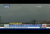
destroyed where a woman was airlifted earlier before we got here, but i'm assuming the area i'm standing in is not quite as bad as the area they're pulling the injured out of. stageal damage in this town called utuwa, north and east of chattanooga, and without a doubt they are ratsed, afraid for what's still to come. there's a warm, humid breeze happening, not like one you would typically see after a thunderstorm. i know the forecast is for storms coming, and there's debris everywhere, they're working frantically to clear the roadways to make this at least passable. >> the calm before the next storm, rob marciano there for us on the ground in chattanooga, tennessee. we are in and out getting word there are 19, 19 tornado warnings, chad myers, in six states. >> that's sobering, isn't it?
12:54 pm
we've been talking a lot about indiana, eventually towards cincinnati, but storms are firing in tennessee, 50e67 one by itself, its own super cell, each one rotating. we go from here, columbus, ohio, tornado warns for richmond, the big rv center, look at all these warnings coming your way. here is louisville, a storm to the west, not really rotating. i'm expecting that to be more of a wind event, at least for right now, but to get back down to the west of nashville, north of huntsville, rob is right there, another storm, tornado to the north of him, and one way up here in the northeast section of georgia. let's do all this together, so i'd like to show you a little closer, here's i-70 out of columbus, there's dayton. tornado warning for you. i'm going to pan down a bit. you have to stay with me here. cincinnati is here, storms and tornadoes coming in, probably on
12:55 pm
up toward hamilton, as this one comes across the indiana border into ohio. er here's the ohio river. storms have crossed the ohio river in milton, kentucky. we know that fire station number 2, according to ems has been destroyed as the storm came across the rivers. more storms will head towards florence, independence, and up i-70 as we go. here's the storm to your west. it's really right now a wind event. tornado warning for you soon, though, louisville. you can't easily see 8 on to 90-mile-per-hour winds, whether it's a tornado or not, that's still a big storm. to the south of there, down here around owensboro, look, every one of these pink box is a tornado warnings. south of nashville from fay yell to winchester, all these pink boxes, because they're all by
12:56 pm
themselves. here's what's happening. you have that cell by itself. it's going to tornado. that cell is not attached to a line, that cell, that cell is going to tornado. when you get them clustered together, then they stop, but when they're all by themselves today, each cell is going to make a tornado, or at least a very, very strong storm with a lot of rotation. it's a big day. 19 tornadoes in six days, right now that number could easily go up. remember we're getting to the heat of the ay,emember the worst part of the day, 5:00 -- we have to get a break in, a quick break. 19 tornado warnings in six separate states. back in 90 seconds. e a body in n tends to stay in motion. staying active can actually ease arthritis symptoms. but if you have arthritis, staying active can be difficult. prescription celebrex can help relieve arthritis pain so your body can stay in motion. because just one 200mg celebrex a day
12:57 pm
can provide 24 hour relief for many with ahris pain and inflammation. plus, in clinical studies, celebrex is proven to improve daily physical function so moving is easier. and celebrex is not a narcotic. when it comes to relieving your arthritis pain, you and your doctor need to balance the benefits with the risks. all prescription nsaids, like celebrex, ibuprofen, naproxen, and meloxicam have the same cardiovascular warning. they all may increase the chance f art attack or stroke, which can lead to death. this chance increases if you have heart disease or risk factors such as high blood pressure or when nsaids are taken for long periods. n inuding celebrex, increase the chance of serious skin or allergic reactions or stomach and intestine problems, such as bleeding and ulcers, which can occur without warning and may cause death. patients also taking aspirin and the elderly are at increased risk for stomach bleeding and ulcers. do not take celebrex if you've had an asthma attack, hives, or other allergies to aspirin, nsaids or sulfonamides. get help right away if you have swelling of the face or throat, or trouble breathing.
12:58 pm
tell your doctor your medical history and find an arthritis treatment for you. visit celebrex.com and ask your doctor about celebrex. for a body in motion. we have now videos from fie we have video of something, if we can look at it. here we go. this is north of louisville from a our affiliate. we know a tornado has not hit the city. we know it was north or west? >> correct, but there are still storms west of louisville moving to the east. louisville, you're not out of it yet. you're not in a warning yet, but expect it in the next 15 to 20 minutes. >> how many hours are we talking, as we look ahead as far
12:59 pm
as potential tornadic activity, so are we talking through midnight? >> i think so. maybe a little later with that with hail and severe winds. tornadoes will start to calm down after dark. they want that heat. even though it's dark at 6:00, it's not cool yet at 6:00, may not cool down under 9:00 or 10:00. that's when the tornadoes may start to get smaller, but for now it's a mess. there was tornado video there. that was the indiana storm that we were looking a that jeff petrowski was on. we are following him for a long time. now we're back -- >> this is as i'm told carroll county, tennessee. these are pictures, and when you look at this, just obviously the wipers are on, it's raining, you were talking early in some parts of these states, tennis ball hail? >> certainly possible. you're
188 Views
IN COLLECTIONS
CNN (San Francisco) Television Archive
  Television Archive News Search Service
  The Chin Grimes TV News Archive
Uploaded by TV Archive on
